Geographically the Normandy coastline stretches west from Cap Levi to the Seine estuary (and administratively a bit further north) is an interesting and varied cruising ground. Mostof the coastline is rather flat and with considerable tidal differences but ports such as Cherbourg and Oustriham may be entered 24 hrs around the clock. However, we are particularly fond of Sainte-Vaast la Hougue epitomizing Normandy: Oysters, Cheese, Calvados and all the other exquisite local foodstuffs available.
Further east the WW2 invasion coast where thousands of young men risked their life on the 6th of June 1944 and everywhere along the coast there are interesting localities relating to this important day. We visited Normandy in 2000.
 |
 |
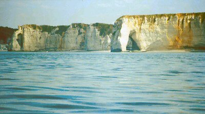
| Côte dé Alabatre has some marvelous chalk formations. Geologically they correspond to the White Cliffs of Dover |
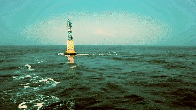
As this boy north east of Cherbourg shows the tidal current is considerable and one should not pass to close to windward |
|
|
 |
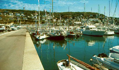
| The port in Fecamp at high tide. Touch the picture with the cursor and watch the same spot at low tide |
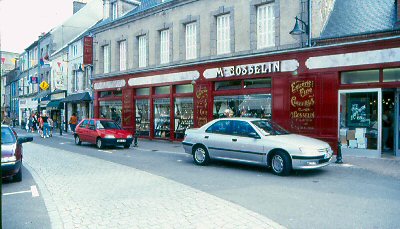
The well stocked shop of Monsieur Gosselin: everything that the heart can desire. Delivery at dockside |
 |
 |
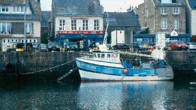
| Along the town quay in Sainte-Vaast |
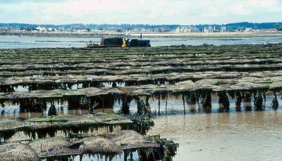
One of the most important crops of the Nomandy coast: Oysters |
 |
 |
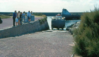
| The coach between Sainte-Vaast and Ille Tatihou has amphibious capabilities. Driving at low- sailing at high tide |
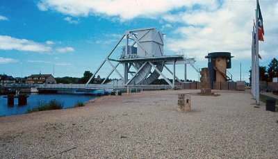
The famous Pegasus bridge where British airborn troops were the first to land at night before D-day |
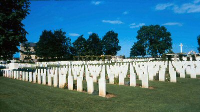 |
|
| A sinister memory of D-day |
Back to the Cruising Scandinavia map